


Based on 50 reviews
powered by Google

Brendan and team were great to deal with and replied very quick to a request for a quote. Very approachable and spent time carefully analysing the job in detail. Much appreciated!!

I recently had the pleasure of working with Paint Melbourne, and I cannot recommend them highly enough. Although I wasn't the one who contracted their services-the owners of the upstairs apartment engaged them to rectify extensive damage from a poorly executed plumbing job-I was directly impacted as the work involved stabilising the cement ceiling slab, replastering and repainting my apartment.
From the outset, Paint Melbourne impressed me with their clear and consistent communication. Despite facing significant challenges from insurance companies and coordinating with multiple apartment owners, they kept me informed at every stage of the process. Everything unfolded just as they had outlined at the beginning, with no unexpected delays or surprises. Their commitment to transparency and reliability made a potentially stressful situation remarkably smooth.
The team’s attention to detail was outstanding. Each trade professional on site knew exactly what needed to be done and approached their tasks with expertise and care. They treated my property with the utmost respect, ensuring that everything was protected and left spotless at the end of each day. The painters and plasterers were meticulous, and the result is truly impeccable-my apartment looks better than ever.
Beyond the technical quality, I appreciated the professionalism and courtesy of everyone involved. They were punctual, efficient, and always approachable if I had questions or concerns. It’s rare to find a company that combines such high standards of workmanship with genuine customer care. I’ve seen firsthand how they handle complex jobs and challenging circumstances without compromising on quality or service.
I will absolutely be recommending Paint Melbourne to friends, Neighbours, and anyone seeking reliable, high-quality painting and restoration work. They’ve certainly earned my trust and gratitude for a job exceptionally well done

Spoke to Krishna about Remedial Building Repairs for a high rise project that we are working on

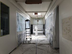
Paint Melbourne were contracted to paint the external walls and internal walls and ceilings of my unit in Abbotsford.
Evan the painter was very professional in his approach to the painting works and I was extremely happy with the end result.
I have no hesitation in using Paint Melbourne for my next painting project and I can recommend them to anyone requiring quality painting services.
Paul
Evan the painter was very professional in his approach to the painting works and I was extremely happy with the end result.
I have no hesitation in using Paint Melbourne for my next painting project and I can recommend them to anyone requiring quality painting services.
Paul

We were very impressed with the professional service and quality outcome in dealing with Paint Melbourne. Every person we dealt with was pleasant, professional and customer-focussed.From Brendan who provided efficient service with quoting, organising permits and consistently good communication, to Evan and Matt who did an excellent painting job. It was tricky paint and repair work on windows, many at a high levels and they took great care as well as showing attention to detail. It was a pleasure to have these tradies who were so respectful, did not have loud music and communicated at all times pleasantly to each other and to me. The project was expensive but we feel we got value for money and it was a smooth, highly competent operation getting the job done.

Evan, Marek and Matt did an amazing job on our very high windows. They were professional, with good attention to detail. They were punctual and nice people completing a thorough job. We will get them back when the need arises.

December 2024 and January 2025 - I asked Paint Melbourne to return for a new job at Marine Parade; we wanted to update and renovate our front vestibule entry to the apartments. Paint Melbourne were again very professional and efficient. I love dealing with this company, it is a pleasure in every way from the front office, to the project manager guy who comes to quote on the job and who handles the project as a project manager. Marek, the painter who did the rendering of a new wall and the painting was fantastic, also a terrific worker. Malek who took great pride in his work, was so efficient and punctual and did everything when he said he would and finished absolutely on time and did a superb job. He was delightful to have to do our work. I am extremely happy in every way.
we will get Paint Melbourne to quote on painting our exterior of the building when we do it. I recommend them most highly. Thank you all - Tonya Jennings Marine Parade, St Kilda, 3182
Paint Melbourne came Monday and Tuesday this week, 26 and 27 April, 2021, to complete the render work on our front facia and to paint it. The men had to match the colour which they did perfectly! They were extremely professional and carried out the work very nicely. They were a great crew and were very pleasant people with whom to deal and work.
They are sending their report with the account. We will remember them for our future Body Corporate painting and rendering projects.

The team at Paint Melbourne are professional, responsive and reasonably priced. A pleasure to do business with and would highly recommend them.

Amazing job! Very professional, clean and well priced painting company! Highly recommend and will be using them again in the future! 👍

After struggling to find a painter to quote for the commercial building I lease on Toorak Road, I came across Paint Melbourne. The whole process from quoting to completion was absolutely seamless. Marek and his crew were professional, skilled and a delight to deal with. Marek’s knowledge and attention to detail was excellent and the whole team were extremely hard working.
Also, Marek stayed back after the team left and left the whole area spotless which is much cleaner than it was originally. The building is extremely old and was in desperate need of painting. The transformation has been incredible and I would highly recommend Marek and Paint Melbourne to tackle the most difficult of jobs. It’s such a pleasure to deal with people who know what they are doing.
Also, Marek stayed back after the team left and left the whole area spotless which is much cleaner than it was originally. The building is extremely old and was in desperate need of painting. The transformation has been incredible and I would highly recommend Marek and Paint Melbourne to tackle the most difficult of jobs. It’s such a pleasure to deal with people who know what they are doing.

Had a great experience with engaging Paint Melbourne to do some render repairs and a full external repaint of our townhouse. They were very prompt on getting back with an inspection of the works and a quote. Marek was our key on-site contact. Marek kept us up-to-date with the works as they progressed. Marek ensured the works were completed to a very high standard and to the specification of the agreed works. Marek completed the works within the time-frame expected and left the site in a very tidy condition at the finish. I would certainly recommend Marek and Paint Melbourne for any render and painting works you have.

I found Jason to be talented, calm and pleasant in all his dealings with so many different people. I met Jason every morning at 6.45 am, he was never late. I found him to not only be hard working and knowledgeable, but he could handle various issues pertaining to the work on that day. He also has great sense of humour. Paint Melbourne are very fortunate to have a person of his talent and skill as part of their organisation. He was also well supported by Matt and Ivan, two wonderful workers in their own right.
Krishna is obviously skilled at selecting the most talented and hard-working staff. I have no hesitation in recommending Paint Melbourne.
Phil
Krishna is obviously skilled at selecting the most talented and hard-working staff. I have no hesitation in recommending Paint Melbourne.
Phil

Paint Melbourne restored and painted our Art Deco apartment block and brought the beauty back to the building. Jason, you are so skilled, a real problem solver and a pleasure to deal with. Every day you came to work with a smile on your face and worked your magic. I will always be grateful for how you got the job done and you should be so proud of the work you have done which will be admired for years to come. Matt and Ivan were also paramount in the successful restoration. They worked so hard and took great pride in their work. Rob, from Hawk and Trowel Solid Plastering replicated the moulds to replace those that were missing. He is a magician.Thanks Krishna.

The team at Paint Melbourne did a great job cleaning, painting and repairing the façade of our hotel in the CBD.
Huge shout out to Krishna and Anthony. It was genuinely nice to work with you and your team. Thanks for all the help.
Huge shout out to Krishna and Anthony. It was genuinely nice to work with you and your team. Thanks for all the help.


Jason, Joy & Jack did an amazing job on repairing and painting the render on the front of our house. They were really easy to deal with and went out of their way to make the process seamless. I would highly recommend using Paint Melbourne

Would like to thank the team for your help on delivering a wonder product to my clients and my business. Also a special thank you to Geusape and Jack for professional manner and great work ethic!

Peter, Jason and the Paint Melbourne crew were phenomenal on our heritage project. They painted the facade of 8 conjoined terraces, which involved heritage overlay complications and complex stakeholder management with all the owners. They approached our project with passion and were driven to get the best result. We are so happy with the painted facade, the team’s professionalism, responsiveness and care. We would recommend PM every time.


Our apartment complex used Paint Melbourne to refurbish our pool area.
They did a thorough job and matched our budget and timing requirements. A much needed and delayed update has been well done
They did a thorough job and matched our budget and timing requirements. A much needed and delayed update has been well done

We have just finished getting our house fully painted inside including all the trimming, cupboard doors, ceilings, bi fold doors and front door. We went with Paint Melbourne because their painter Mark is one of the best painters I have ever seen. His attention to detail is fantastic and he doesnt leave a mess behind him. We had seen his work previously and knew we wanted him to paint our forever home.
Would recommend Paint Melbourne if you need your house painting project managed due to the large volume of work as we had, and if you are after quality painting.
Would recommend Paint Melbourne if you need your house painting project managed due to the large volume of work as we had, and if you are after quality painting.

Very happy with the quality, price and customer service provided by Paint Melbourne.
The work was done on time and Pete was flexible enough to accommodate a last minute change in schedule. Highly recommended
The work was done on time and Pete was flexible enough to accommodate a last minute change in schedule. Highly recommended

Paint Melbourne from the first phone call were very professional, asking very through questions to be able to provide an accurate as possible quote. Everyone was a delight to speak with. It took a little longer than expected to receive a quote, however it was received in the end. Had someone come in to inspect and take a paint sample, from there lock a time in. We were happy with the price, the realistic expectation in regards to the time it would take and the paint used did not leave a heavy linger chemical smell. I would recommend them if you need a professional finished job.

Very professional and reliable company to work with they also made sure we were happy with the colour selection after multiple attempts to match the colour. Completed the whole project in a couple of days with no issues, painting crew were excellent in all aspects and would highly recommend them to anyone.

Paint Melbourne undertook the massive task of painting the exterior of our 9 story block of flats in Middle Park during winter!
As we had just had brand new windows, installed they also has to cover and seal every window prior to painting the walls, which was a huge task in itself.
The crew on site were so friendly and professional, at all times. Supervisor Richard was always here and helped with any requests. Peter, Nathan and the other crew members (sorry cant remember their names!) were all great. Nothing was a problem. Always happy and smiling.
Unlike other contractors we have had on site, they came early, got stuck into the work, often staying late in to the afternoon and left quietly. No loud radios blaring, yelling and swearing as we have had in the past with other tradesmen.
I would thoroughly recommend Paint Melbourne for any size job, if you want a professional job done. Thank you Paint Melbourne.

I had my apartment repainted and I couldn't be happier with the outcome. The team were professional all the way through and were just a pleasure to deal with. An honest and reliable team, which I highly recommend and would use again.

Anyone involved in maintenance for Owners Corporations will know how difficult it is sometimes to find the right tradesperson or contractor to keep all owners happy. Paint Melbourne is the perfect solution! I cannot speak highly enough of the entire team at Paint Melbourne, from the quote stage, through project management, to the delivery of friendly and exceptional service. Nothing is too much trouble for these guys. Their motto says it all: Do it once Do it right. And they do!
Janet Lambrou, Middle Park
Janet Lambrou, Middle Park

John and Richard did a great job on our house. No shortcuts with these guys they take a lot of pride in their work and are very professional and reliable. Made some great suggestions on colours and finishes too.

They worked late hours to get the car done and did an absolutely amazing job! She has even had people comment on how awesome the car colour looks

Paint Melbourne - Fantastic Work - exterior and interior
The transformation of the exterior of my apartment building is fantastic. Its new colour looks fresh, clean and modern. Richard and his team have delivered a very thorough and professional job. They went above and beyond to assist whenever possible.
The interior of my apartment looks like new. Peter and his team were extremely professional from start to finish. Their preparation was meticulous, they noticed and attended to extra details, they communicated with me and were very organised for the job.
The teams from Paint Melbourne were reliable, hardworking, polite and delivered very high quality workmanship.
If you want quality and professionalism look no further than Paint Melbourne.

Excellent company. A very large project 9 floors 34 apartment. Despite difficult weather conditions the project at Lakeside Canterbury Rd. Middle Park has been handled in an efficient and professional manner .

Just want to say thankyou for the friendly and helpful attitude from the Paint Melbourne crew.
The COVID-19 restrictions don't stop them from stepping out of their way to assist even at a distance - today we had some removalist trucks in the area and Richard anticipated what I might need and protected our furniture from the wind and the weather. Big shout out to him from my whole family.
Alanna
Middle Park

The Owners Corporate engaged Paint Melbourne to paint our 9 story apartment block In Middle Park, where I am an owner occupier. All of the team were extremely helpful and went out of their way to ensure that they got the job done as quickly and efficiently as possible. The onsite Supervisor Richard was always on hand to assist with any queries and made sure the project ran smoothly. The extra attention to detail and great customer service from all the staff, was very professional at all times. I highly recommend Paint Melbourne.

What can I say. These guys are by far the best painters we have ever used. There workmanship and quality is amazing. They treat your home like it’s there own home. I would highly recommend paint Melbourne for any painting or restoration work.
Thanks
Thanks

